Broad Run Farms is an established Sterling neighborhood near the meeting of Broad Run and the Potomac River. It grew from the subdivision of a 706-acre farm in the early 1950s, with individual home lots and shared river-access property. A voluntary civic association maintains community spaces and organizes activities, while nearby Algonkian Regional Park provides separate public riverfront recreation.
Broad Run Farms grew from the former Miskel Farm in the early 1950s. The 706-acre farm was divided into individual building lots, with shared access to Broad Run and the Potomac forming part of the neighborhood’s original plan.
The civic association maintains community spaces and organizes local activities. Water infrastructure is a separate practical consideration: the EPA’s Hidden Lane Landfill waterline project and Loudoun Water’s extension for the remaining Broad Run Farms area serve different project areas. A home’s location and connection status need to be checked individually.
River visits and address research
Public park information and county maps provide useful starting points for exploring the area around Broad Run Farms.
Public access at Bles Park
Bles Park at 44830 Bles Park Drive in Ashburn is a public county park across Broad Run from the neighborhood. Natural trails include a portion of the Potomac Heritage National Scenic Trail, with a canoe and kayak launch along Broad Run. A park map and field-status link help plan a visit.
Loudoun County’s WebLogis mapping system offers street-address searches and layers for parcel boundaries, aerial imagery and floodplain. The county’s floodplain guide explains how to turn on the environmental layer and describes its boundary display as approximate. Use the specific address when researching a home.
Broad Run Farms developed as a neighborhood of individual building lots rather than one building complex. Homes and lot settings vary across its residential streets. For an individual property, confirm the water service, recorded access and applicable county records rather than relying on the neighborhood name alone.
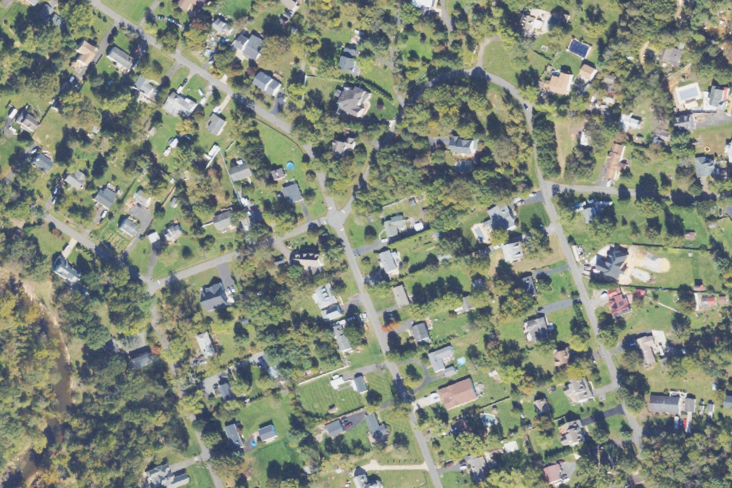
Aerial photograph: detached homes and large residential lots in Broad Run Farms. NAIP imagery acquired October 11, 2023. The photograph shows conditions at that time.Photo: USDA NAIP / USGS The National Map · Public domain · Resized and JPEG-compressed for the web; no scene elements altered.
Local history and community life
A scholarship supported locally
The civic association runs a community scholarship for neighborhood high-school seniors, recognizing service and participation as they pursue further education or training.
A one-room public school once stood on the east side of today’s Lakeside Drive. It closed in 1922, and the building was later moved to another location.
Project-area mapping, construction updates and information about water-service connections.
Broad Run Farms questions
Are the two waterline projects the same?
No. The EPA’s Hidden Lane Landfill project and Loudoun Water’s extension for the remaining Broad Run Farms area cover different project areas.
Does the extension page establish that a home is connected?
No. A project-area map does not establish whether a particular home is connected. Confirm the property’s service and connection status directly with Loudoun Water.
Is there public riverfront recreation nearby?
Algonkian Regional Park provides public Potomac-side recreation outside Broad Run Farms. The civic association’s river property has separate member access arrangements.